By Santa Cruz Profunda, from Puerto San Julián · Updated 2026-10-15
Gobernador Gregores is a town in central Santa Cruz, on the banks of the Chico River. It is the seat of the Río Chico department and, according to the 2022 census, has 5,343 inhabitants. It isn't on the classic circuits, but anyone traveling across the plateau ends up passing through.
The reason is practical: it is the closest town to Perito Moreno National Park, whose headquarters are in town. It is also a base for fishing in lakes Cardiel and Strobel and for visiting one of the harshest sites in Patagonian history, the Cañadón de los Muertos.
If you're wondering what to do in Gobernador Gregores, the answer mixes wide-open nature, estancias and memory. Here is what you need to know to plan your visit. The general overview is at Gobernador Gregores and Lake Cardiel.
Where it is and how to get there
Gregores is in the center of the province, on National Route 40. According to Turismo Ruta 40, the current paved alignment reaches the town from the Cruce Cardiel junction (62 km), and it is 173 km from Tres Lagos. The old Route 40 alignment, now gravel Provincial Route 29, heads straight north to Casa Riera, on the Chico River, and bypasses the town.
From the coast, you reach Gregores on Provincial Route 25 from Puerto San Julián and on Provincial Route 27 from Comandante Luis Piedra Buena.
Distances from Gobernador Gregores
| Destination | Approximate distance |
|---|---|
| Pico Truncado | 202 km |
| Puerto San Julián | 209 km |
| Comandante Luis Piedra Buena | 210 km |
| Perito Moreno National Park | 220 km |
| Puerto Santa Cruz | 230 km |
| El Calafate | 335 km |
| Perito Moreno (town) | 363 km |
| Río Gallegos | 436 km |
| Los Antiguos | 437 km |
| Caleta Olivia | 552 km |
| Puerto Deseado | 635 km |
Distances come from Interpatagonia's table, except the one to the park, which is the figure published by National Parks. They are approximate: depending on the road you take, they may vary by a few kilometers.
By bus
According to National Parks, the Taqsa bus line reaches Gobernador Gregores and connects it with Perito Moreno to the north and Piedra Buena to the south. Schedules and frequencies change with the season: check with the company.
A bit of history
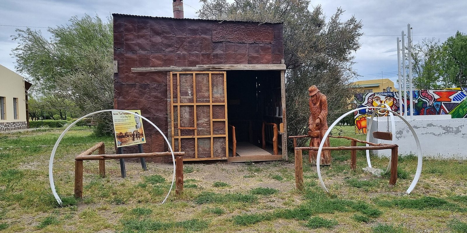
The town was first called Cañadón León, after a nearby canyon where pumas lived. That name became official in 1925. One of its first settlers was the Austrian José Kuney Posne, who set up a blacksmith's shop on the riverbank: it was the first dwelling in the area.
In 1938 the first Development Commission (Comisión de Fomento) was formed and an urban area of 1,000 hectares was set. In 1958, at the residents' request, the town took its current name, in honor of Juan Manuel Gregores, former governor of the Territory of Santa Cruz.
The area was the scene of the rural strikes of 1920 and 1921, known as the Patagonia rebelde (Rebel Patagonia).
Things to do in Gobernador Gregores
Visit the Cañadón de los Muertos
It is a site where striking farmhands were executed in late 1921 by the 10th Cavalry Regiment. Today there is a cross and a plaque honoring the victims. The episode appears in the work of Osvaldo Bayer and in the film La Patagonia rebelde (1974).
To get there, take Provincial Route 27 for 7 km and then go about 800 meters across the land of Estancia Bella Vista, which is private: going with a guide is recommended. The Ruta de la Huelga de 1921 (1921 Strike Route), a private venture based in town, advertises a local tour of about three and a half hours (town and Cañadón de los Muertos) and a 12-hour expedition along Route 12 that visits other memorial sites. The historical and tourist circuit of the strikes was created by Provincial Law 3056 and links sites between Gobernador Gregores, Jaramillo and Puerto Deseado. For schedules and rates, check before you travel at Ruta de la Huelga de 1921 – Excursiones en Gregores.
Go to Perito Moreno National Park
This is the main reason to stop in Gregores. According to National Parks, the park is 220 km from town and is open from October 1 to April 30 (this may vary depending on road conditions). You get there via National Route 40 and Provincial Route 37, with about 90 km of gravel, and entry requires registering at the Clemente Onelli Operations Center, from 9 am to 7 pm. There is no store inside: bring everything you will eat. From Gregores you can go in your own vehicle or with transport operators authorized by National Parks.
It has shelters, domes and camping areas that must be booked in advance. Among the trails described by Diario Río Negro are the Península Belgrano loops (9.6 km and 16.8 km), the San Lorenzo trail through the Lácteo River valley (11.5 km) and the Laguna de los Témpanos (5.2 km). The park headquarters are at Paseo 9 de Julio 610, in town. For bookings and the condition of Provincial Route 37, check before you travel at Parques Nacionales – PN Perito Moreno: horarios y cómo llegar.
Fish at Lake Cardiel
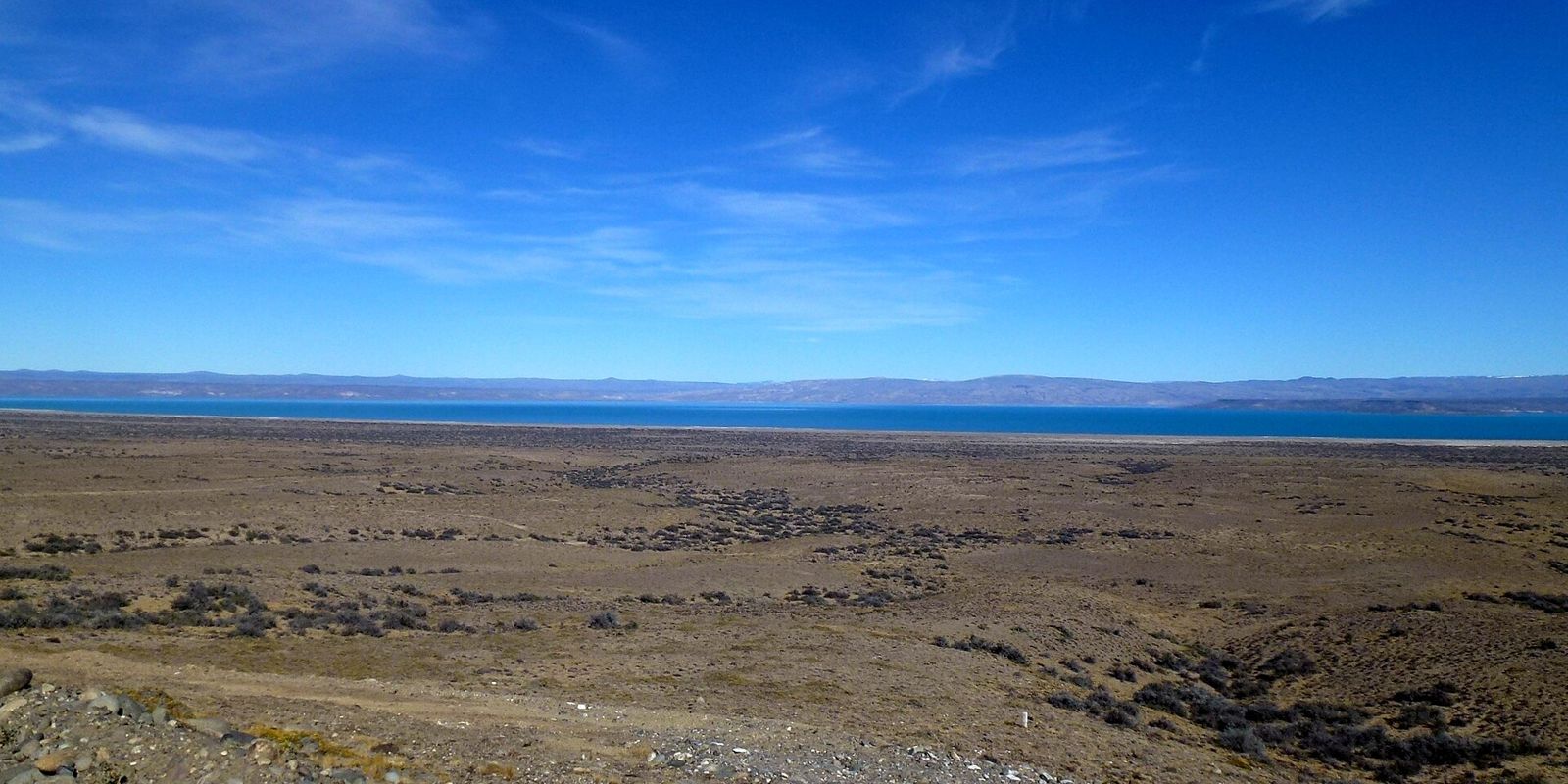
It is one of the large lakes of the plateau and a well-known destination for salmonid sport fishing. Interpatagonia places it about 85 km from town: take Provincial Route 29 west to National Route 40 and then continue south to the shore. On the shore there are only basic anglers' shelters. For fishing seasons and permits, check before you travel at Turismo Santa Cruz – Gobernador Gregores.
Discover Lake Strobel
They call it “Jurassic Lake” because of the size of its trout, and it is famous among fly fishers from all over the world. It covers 65 km² and sits 715 m above sea level. According to Welcome Argentina, it is about 115 km from Gregores, heading north on Provincial Route 25, and can only be reached by 4x4. There is no official road: you get there on dirt tracks that can become impassable when it rains. Several nearby estancias host anglers. The province also promotes archaeological tourism on the Meseta del Strobel plateau.
Explore the town
In the town center are the Museo Fundacional La Herrería and the Sala Adela Yatel Tehuelche Culture Interpretation Center, both with guided visits, and the Casa de Piedra, with documentary and photographic exhibitions. On the Chico River there is a swimming area and you can go horseback riding or kayaking. The Mirador del Valle Norte viewpoint is the starting point for hiking and climbing. For museum hours, ask at the Tourism Office (San Martín 514; according to the province, open Monday to Friday from 9 am to 9 pm).
Stay at an estancia
Several estancias in the area host guests. They offer horseback rides, walks and fishing trips, and the area produces cheeses, cured meats and homemade jams. The town hosts the Provincial Homemade Jam Festival (Fiesta Provincial del Dulce Casero) and is known for growing tulips. For festival dates, check before you travel at Turismo Santa Cruz – Gobernador Gregores. Where to stay and eat: Gobernador Gregores directory.
When to go
The climate is cold and semi-arid. According to National Weather Service (SMN) averages compiled by Wikipedia, about 155 mm of rain falls per year. In January the average high is around 21.6 °C and the average low 9.3 °C. In July the average high drops to 5.6 °C, and in June the average low reaches −4.1 °C. Extremes of 38.5 °C and −22.4 °C have been recorded.
If your goal is Perito Moreno National Park, the window is October to April, when it is open. January and February are the mildest months. Even in summer, pack warm layers and a windbreaker.
How many days to stay
- 1 day: town, museums and Cañadón de los Muertos.
- 2 or 3 days: add Lake Cardiel or a night at an estancia.
- 4 to 6 days: use Gregores as a base to enter Perito Moreno National Park and spend at least 2 or 3 nights inside to do the trails. This is our suggestion.
Travel tips
- Fuel: Gregores has a gas station. Turismo Ruta 40 recommends filling up in Tres Lagos, again in Gregores and once more in Bajo Caracoles: the stretches are long and empty.
- Cash: the same guide warns that some stations may not accept credit cards. Carry cash.
- Vehicle: for Lake Strobel you need a 4x4. For the park, because of the 90 km of gravel, check your car and spare tire carefully before leaving.
- Roads: road conditions change often; check before you travel at Prensa Santa Cruz – Estado de rutas (Vialidad).
- Supplies: buy everything you need for the park in Gregores.
To continue across the plateau and the Andes, see Northern Route 40.
Frequently asked questions
Is Gobernador Gregores on Route 40?
Yes. According to Turismo Ruta 40, the current paved alignment of National Route 40 goes through the town. The old alignment, now gravel Provincial Route 29, bypasses it.
How far is Gobernador Gregores from Perito Moreno National Park?
About 220 km, according to Argentina's National Parks, via National Route 40 and Provincial Route 37, with about 90 km of gravel.
Can you get to Lake Strobel without a 4x4?
It's not advisable. There is no official road and the dirt tracks become impassable when it rains.
Is there fuel in Gobernador Gregores?
Yes, there is a gas station. Even so, fill up at every stop along Route 40.
What happened at the Cañadón de los Muertos?
In 1921, during the rural strikes, striking farmhands were executed there by the 10th Cavalry Regiment. Today it is a memorial site with a cross and a plaque.