By Santa Cruz Profunda, from Puerto San Julián · Updated 2026-10-20
Río Gallegos is the capital of Santa Cruz and, for many travelers, just a stopover on the way to El Calafate or Tierra del Fuego. That's a common mistake. The city has an estuary with huge tides and thousands of shorebirds, a historic center built of corrugated iron and wood, and the southern tip of the mainland is just a few hours away.
It's not an easy postcard destination: the wind is strong, it's an administrative city and the sights are spread out. But if you give it two or three days, you get Patagonian history, coastal wildlife and volcanic landscapes that almost nobody visits. The general overview is on Río Gallegos.
Where it is and how to get there
Río Gallegos is in southeastern Santa Cruz, on the south bank of the Gallegos River estuary, about 15 km from where it meets the Atlantic. The Integración Austral border crossing into Chile is about 70 km away on National Route 3.
By air
The city has the Piloto Civil Norberto Fernández International Airport. Airlines, routes and frequencies change often: check before you travel at Turismo Santa Cruz – Río Gallegos.
By land
- From the north (Puerto San Julián, Caleta Olivia, Comodoro Rivadavia): on National Route 3.
- From El Calafate: on National Route 40 to Cerrito and then Provincial Route 5, all paved; Interpatagonia puts it at about 280 km.
- From Chile and Tierra del Fuego: through the Integración Austral crossing and National Route 3.
- From Río Turbio: the province gives 220 km via RP 53 and RN 40.
Long-distance buses arrive at the bus terminal. Companies, schedules and frequencies change with the season: check at the terminal before you travel.
Distances from Río Gallegos
| Destination | Approximate distance |
|---|---|
| Punta Arenas (Chile) | 264 km |
| El Calafate | 280 to 306 km depending on the route |
| Puerto San Julián | 354 km |
| Río Grande | 365 km |
| Ushuaia | 601 km |
| Comodoro Rivadavia | 792 km |
| Buenos Aires | 2,604 km |
Distances come from Interpatagonia's table and are approximate. To reach Tierra del Fuego overland you have to go through Chile and cross the Strait of Magellan by ferry.
A bit of history
Río Gallegos was founded on December 19, 1885, when the Argentine Coast Guard (Prefectura) settled in the area to assert Argentine sovereignty over the southern tip of the mainland. In 1888 governor Ramón Lista moved the capital of the Territory of Santa Cruz here from Puerto Santa Cruz, a decision ratified in 1904.
The city grew with sheep farming and with settlers from Britain, the Falklands (Malvinas), Chile, Spain and Italy; later came oil and gas, explored at Cerro Redondo from 1937. The name comes from the river, which honors a pilot named Gallegos on Magellan's 1520 expedition. According to the 2022 census it has 115,524 inhabitants.
Things to do in Río Gallegos
Waterfront and estuary
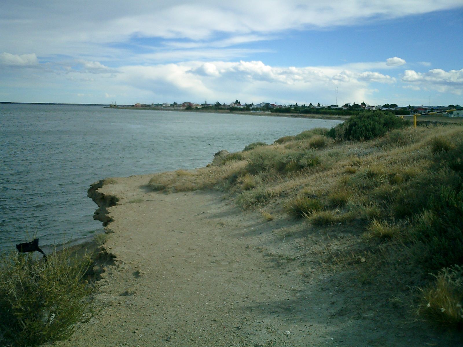
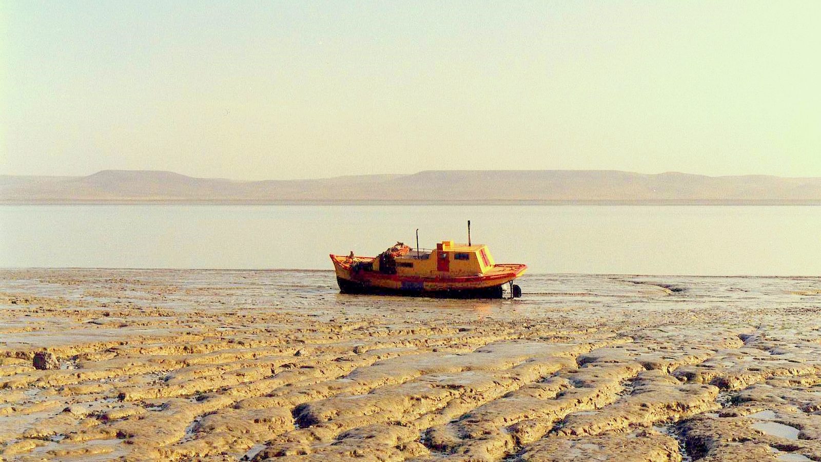
The Ángel Sureda waterfront runs along the estuary, which is about 45 km long, with tides of more than 4 m and maximums close to 13 m: at low tide huge mudflats appear, like the one in the photo. On the waterfront stands the Monument to the Heroic Argentine Pilot, which honors the Air Force pilots killed in the 1982 Falklands (Malvinas) War.
Reserva Costera Urbana and birdwatching
On the south bank of the estuary lies the Reserva Costera Urbana (Urban Coastal Reserve), created in 2004 and covering about 1,500 hectares. The estuary is a site of international importance in the Western Hemisphere Shorebird Reserve Network and receives more than 20,000 shorebirds a year.
You can see red knots, Hudsonian godwits and white-rumped sandpipers, which arrive from the Northern Hemisphere, as well as Magellanic oystercatchers, sheldgeese and Chilean flamingos. On the waterfront, inside the reserve, is the Gallegos River Estuary Interpretation Center, run by the Asociación Ambiente Sur, with one exhibit for adults and another for kids. For opening hours and the months with the most migratory birds, ask at the center or at the tourism office. Check the tide table too: birds come in to feed as the water goes out.
Historic center
You can do the walking tour in a few blocks downtown:
- Balcón de Roca, at Piedrabuena 50, on the corner of Alcorta. It's a National Historic Monument: President Julio A. Roca spoke from here in 1899, on his trip south to meet the Chilean president in Punta Arenas.
- Government House, at Alcorta 231.
- Our Lady of Luján Cathedral, on San Martín avenue facing the square. It's a corrugated iron and wood church built by the Salesians in 1899 and opened in 1900; the province declared it a historic monument in 1983.
Museums
- Museo de los Pioneros (Pioneers Museum): housed in one of the oldest houses in town, it shows how people lived in the early 20th century, with furniture, wool carders and original plans.
- Museo Ferroviario Roberto Galián (Railway Museum): tells the story of the narrow-gauge line that linked Río Gallegos with the Río Turbio coal mines, opened on May 25, 1951.
- Museo Casa Gregores and Naval Museum: on Alcorta street, according to Interpatagonia.
Opening hours, days and admission change: check before you travel at Turismo Santa Cruz – Río Gallegos.
Day trips from Río Gallegos
Cabo Vírgenes and its penguin colony
This is the main day trip. Cabo Vírgenes is the southern tip of mainland Argentina and kilometer 0 of Route 40. You drive about 16 km south on RN 3 and then take RP 1, a gravel road: 139 km in total according to SiFAP (the national protected areas system).
The provincial reserve, created in 1986, protects a colony of Magellanic penguins that nest between September and April. The lighthouse, from 1904, is about 26 m tall and its light reaches more than 40 km. On the way you can detour to Estancia Monte Dinero, which is open for farm tourism. According to Billiken, in 2025 entry to the reserve was free; for the season, hours and road conditions, check before you travel at Turismo Santa Cruz – Audioguía Reserva Provincial Cabo Vírgenes.
There is no fuel and there are no services on the road. Leave with a full tank, water and food.
Laguna Azul
About 62 km south on RN 3. It's a lake inside the crater of an inactive volcano in the Pali Aike volcanic field, about 560 m across, and it has been a provincial geological reserve since 2005. Access and hours: check before you travel at Turismo Santa Cruz – Audioguía Río Gallegos a Laguna Azul. More details on Laguna Azul.
Punta Loyola
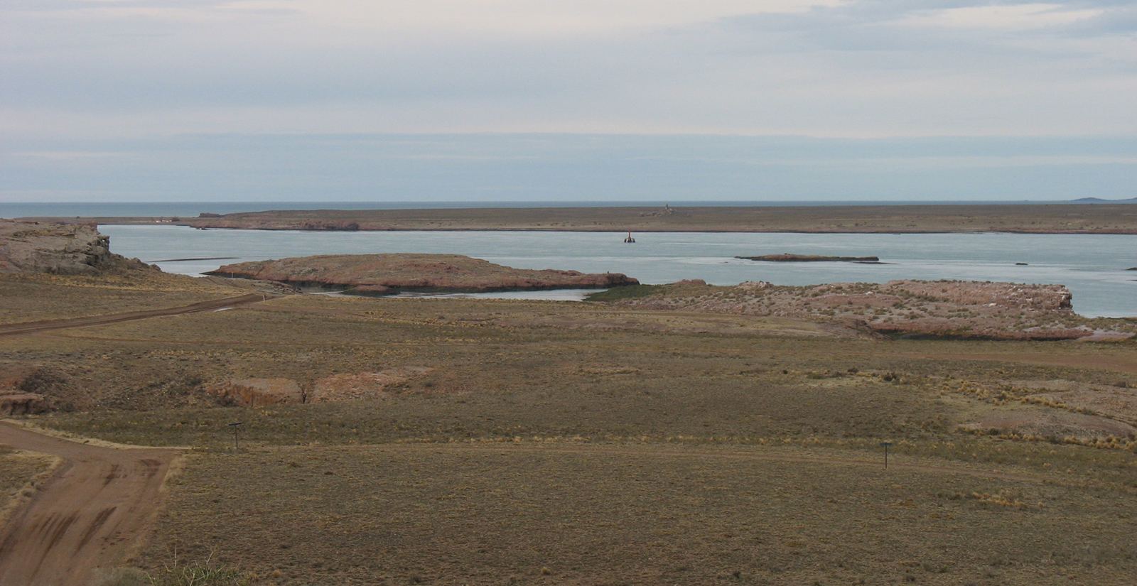
Close to the city, where the estuary meets the sea. There are rusty hulls of old ships on the shore and, across the water, Isla Deseada, with colonies of penguins, cormorants and gulls. It's a well-known spot for sea fishing.
Estancias
- Hill Station: 64 km away, north on RN 3 and then on RP 58, a gravel road. It has an 1899 homestead and offers horseback riding, ranch work and trout fishing.
- Monte Dinero: on the road to Cabo Vírgenes, with five generations of the Fenton family raising sheep.
Opening season and bookings: check with each estancia before you go.
Fly fishing
The Gallegos River, upstream toward the Andes, is known for brown trout fly fishing. Before you go, check the season dates and the current fishing license rules in Santa Cruz.
When to go
Río Gallegos has a cold, semi-arid climate. It rains little, about 277 mm a year, but the west wind is constant and 50 km/h is common.
| Month | Avg. high | Avg. low |
|---|---|---|
| January | 20 °C | 7 °C |
| April | 13 °C | 3 °C |
| July | 5 °C | −2 °C |
| October | 15 °C | 2 °C |
Data from Argentina's National Weather Service (SMN) compiled by Wikipedia, rounded.
In our view, the best time is November to March: it matches the penguin season at Cabo Vírgenes and the long days. In winter there's frost and snow, and gravel roads can get tricky.
How many days to stay
Visit Argentina suggests 2 to 4 days.
- 2 days: the city and the estuary, plus Cabo Vírgenes.
- 3 days: add Laguna Azul and Punta Loyola.
- 4 days: add an estancia or a fishing trip.
Travel tips
- Bring a windbreaker year-round.
- Fill up before heading to Cabo Vírgenes.
- Check the tide table for birdwatching on the estuary.
- If you're continuing to Tierra del Fuego, bring the documents you need to cross into Chile.
- Drive slowly on gravel; check before you travel at Prensa Santa Cruz – Estado de rutas (Vialidad).
Where to sleep and eat: business directory. To continue along the coast, see The coast on Route 3; to the north there's also Monte León National Park.
Frequently asked questions
Is Río Gallegos worth staying in, or is it just a stopover?
It's worth at least one full day for Cabo Vírgenes and another for the city and the estuary. Visit Argentina recommends 2 to 4 days.
Can you get to Cabo Vírgenes without a car?
You can go in your own car or on an organized tour. Ask about departures and the season at the Río Gallegos tourism office.
How far is it from El Calafate to Río Gallegos?
About 280 km via Route 40 to Cerrito and then Provincial Route 5, all paved, according to Interpatagonia.
Are there penguins at Cabo Vírgenes all year round?
No. Magellanic penguins come to nest between September and April.