By Santa Cruz Profunda, from Puerto San Julián · Updated 2026-10-17
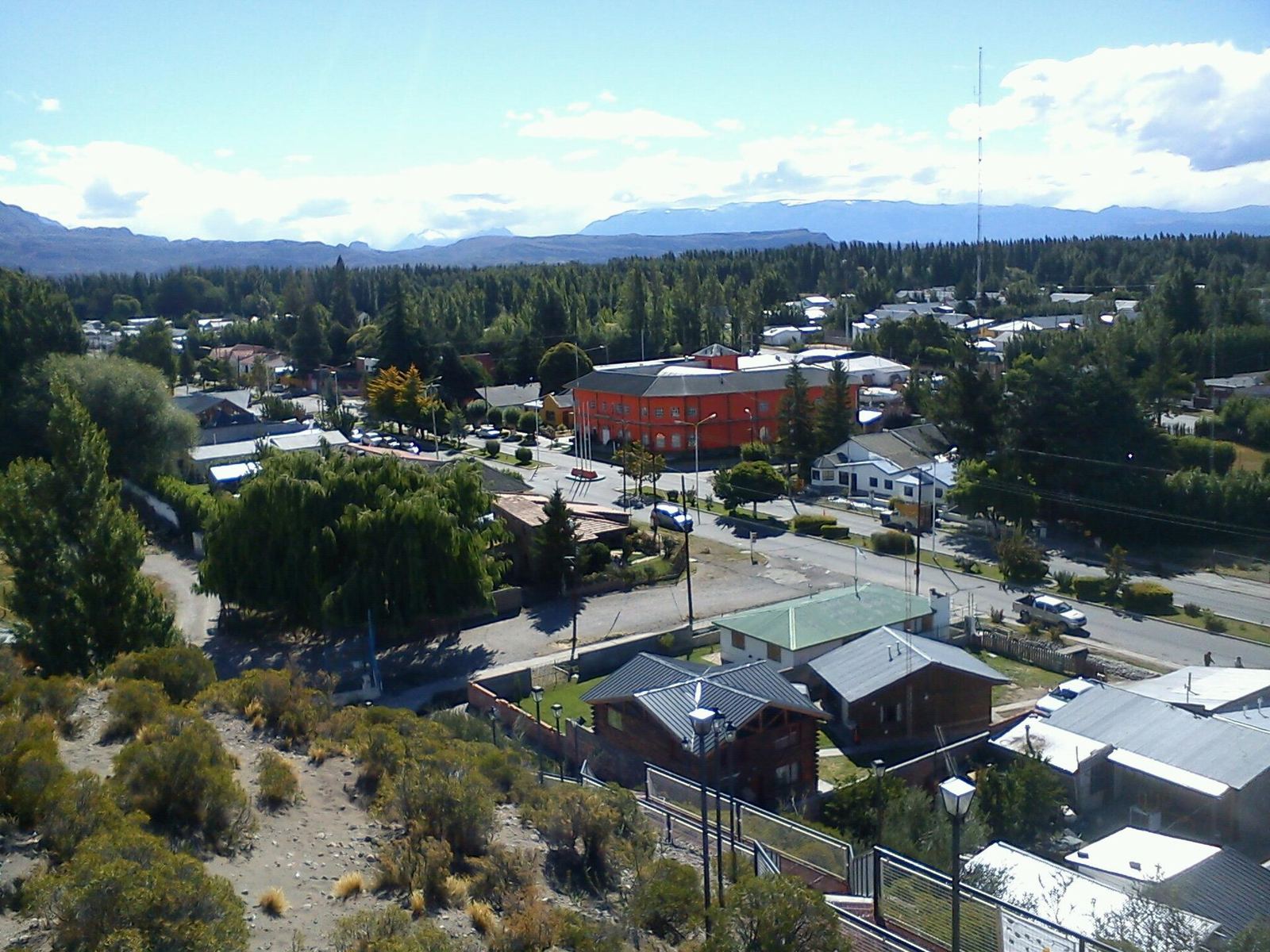
Perito Moreno is a town in northwestern Santa Cruz and has nothing to do with the glacier, which is about 800 km away, near El Calafate. It is the seat of the Lago Buenos Aires department and sits right where National Route 40 meets Provincial Route 43.
For many travelers it is just a pit stop: refuel, sleep and move on. But it has a lot more to offer. It is the gateway to the Cueva de las Manos and Alero Charcamata, it has a wetland with black-necked swans right in town, and it is 60 km from Los Antiguos, on Lake Buenos Aires.
In 1981 it was declared the Archaeological Capital of Santa Cruz because of its proximity to the rock art of the Río Pinturas canyon. According to the 2022 census it has 7,812 inhabitants. The general overview is at Perito Moreno.
Where it is and how to get there
The town lies in the valley of the Fénix Grande River, near the springs where the Deseado River is born. Route 43 links it with the Atlantic coast (via Pico Truncado and Caleta Olivia) and with Los Antiguos and the Chilean border. Route 40 runs through it from north to south.
| From / to | Approximate distance |
|---|---|
| Los Antiguos | 60 km |
| Chile Chico (Chile) | 65 km |
| Pico Truncado | 226 km |
| Gobernador Gregores | 363 km |
| Comodoro Rivadavia | 386 km |
| Puerto Deseado | 421 km |
| Comandante Luis Piedra Buena | 563 km |
| El Calafate | 801 km |
The distances come from Interpatagonia's table and are approximate. From Comodoro Rivadavia the road is paved all the way: National Route 3 to Caleta Olivia, Provincial Route 12 to Pico Truncado and then Route 43.
By bus
According to the province, there are direct buses from Comodoro Rivadavia, El Calafate and Bariloche. The municipal website places the bus terminal on Route 43 and lists Cooperativa Sportman among the transport companies. Companies, schedules and frequencies change with the season: check them before you travel.
By air
The airfield is about 7 km northwest of town. The province mentions LADE flights from Comodoro Rivadavia, El Calafate and Río Gallegos, but they aren't always running: check before you travel at Turismo Santa Cruz – Perito Moreno.
Border crossings to Chile
According to Interpatagonia, the Paso Jeinimeni (Los Antiguos–Chile Chico) is 62 km from town, along the shore of Lake Buenos Aires. Paso Huemules, toward Coyhaique, is about 150 km away via Route 40 and Provincial Route 55; on the Argentine side it is compacted gravel. Hours and requirements change: check them before you set off.
A bit of history
The Tehuelche people called this place Pari-Aike, “place of reeds”. Sources disagree on the founding year: Welcome Argentina says 1890 and other guides say 1910, when the spot served as a rest stop for travelers by the springs of the Deseado.
In 1952 it took the name of Francisco Pascasio Moreno, the “perito” (expert), by decree 10,471, in tribute to the man who worked to secure Argentine sovereignty along the border with Chile. The first settlers came from diverse backgrounds (Spanish, English, Arab and Italian, along with the region's Indigenous peoples) and lived off farming and livestock. Today the valley still produces berries and fruit such as strawberries, cherries and raspberries, plus vegetables.
Things to do in Perito Moreno
Laguna de los Cisnes
It is a lagoon right in town, fed by the Fénix Grande River, and today it is a protected natural area. After years of neglect and drought, at the end of 2020 crews started digging up its bed. A group of residents, many of them young professionals, gathered 790 signatures in two days and managed to stop the work. That is how Vecinos por la Laguna was born; the group cleaned canals, removed trash and put up signs.
With the 2021 snowmelt the lagoon filled up again. The ducks came back at the end of that year and, in January 2022, the black-necked swans. Then came the coypu, Coscoroba swans and coots. The 2022 bird counts recorded around 100 species, and in October 2024 the ordinance defining the municipal reserve was approved. There is a trail around it: bring binoculars.
Punto Panorámico (lookout)
Welcome Argentina calls it the town's must-see. From there you can see Laguna de los Cisnes and the river valleys around Perito Moreno. For directions, ask at the tourism office (Av. San Martín 2005 and Gendarmería).
Carlos Gradin Archaeology Museum
It is the local archaeology museum, at Rivadavia 972. It shows the life of the hunter-gatherers who inhabited Patagonia and includes part of the Cueva de las Manos collection, with pieces up to 9,300 years old. It is named after Carlos J. Gradin (1918-2002), the researcher who led the studies of the Cave. A group of residents promoted it and it opened on December 1, 2018. It has a room devoted to Gradin and a play area for kids. For opening hours, check before you travel at Turismo Perito Moreno – Museo de Arqueología Carlos J. Gradin.
Salón Iturrioz
It is one of the town's heritage buildings, declared a Provincial Historic Monument. It was Pedro Iturrioz's home and carpentry shop, and the town's first movie was screened there in the 1930s. Today it displays objects from the old general stores, hosts exhibitions and cultural events, and has a café. According to the municipal website, it opens with extended hours in high season (October to May).
Cueva de las Manos
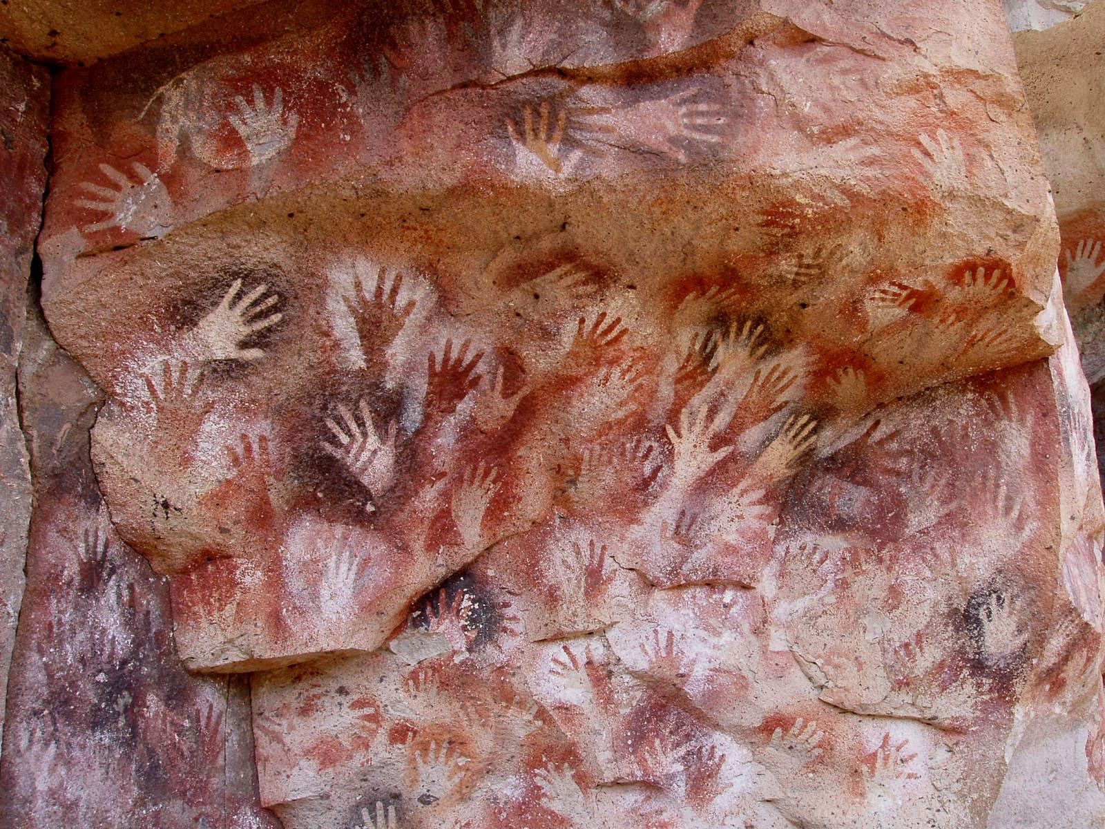
It's the main reason to come. Its rock art is more than 9,000 years old: hand stencils, guanaco hunting scenes and geometric figures. It has been a National Historic Monument since 1993, a UNESCO World Heritage Site since 1999 and a Provincial Park since 2018.
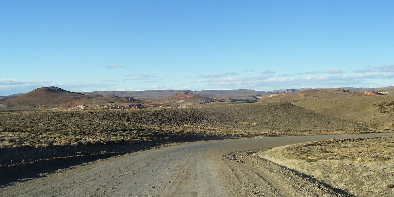
According to the municipal website, the site is 114 km south of town and has three accesses off Route 40: on foot from the Portal Cañadón Pinturas (54 km away, via the Bajada de los Toldos, high difficulty), via Provincial Route 101 (80 km away, with 28 km of gravel in poor condition, 4x4 only) and via Provincial Route 97 from Bajo Caracoles (130 km away, with 47 km of gravel in fair condition, fine for regular cars). It is open year-round, although access is limited in winter because of the weather. It can only be visited with a site guide, in groups of up to 20 people leaving every hour. Camping is not allowed: bring food and drinks for the day. Plan on a full day. More details in how to get to the Cueva de las Manos; for hours and fees, check before you travel at Turismo Perito Moreno – Parque Provincial Cueva de las Manos.
Alero Charcamata
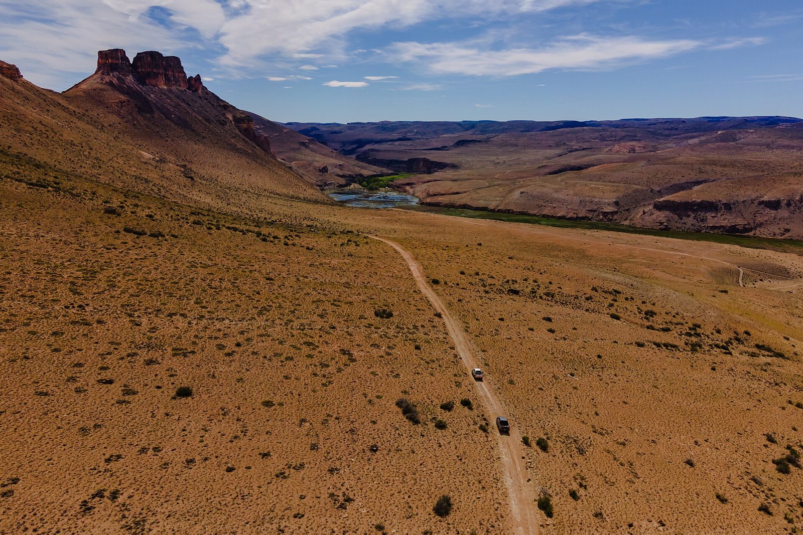
You get there through the Portal Cañadón Pinturas of Parque Patagonia, 54 km south of town, on a guided trip that leaves from Perito Moreno. The internal road crosses neighboring ranches and the vehicle fords the Pinturas River. From there it is an easy walk of about 2 km through the canyon.
The rock shelter is about 80 m wide at the mouth, 40 m high and more than 20 m deep. It has paintings of hands, pumas, guanacos, rheas and geometric figures over 5,000 years old, preserved without modern intervention. The Elsa Rosenvasser Feher Interpretation Center and Planetarium operates at the same portal, a good stop before you start walking.
Lake Buenos Aires and Los Antiguos
The lake is about 30 km from town. It is shared with Chile (on the Chilean side it is called General Carrera) and covers 2,240 km² in total. According to the municipal website, you can fish year-round for rainbow and brown trout, and go kayaking and boating. Following its shore you reach Los Antiguos, 60 km away.
Farther afield: lakes Posadas and Pueyrredón
From Perito Moreno you can also set up trips to lakes Posadas and Pueyrredón, to the south, which share a landscape of steppe and mountains. They deserve a trip of their own: see Lago Posadas.
When to go
The climate is cold and semi-arid. According to the National Weather Service averages compiled by Wikipedia, it gets about 163 mm of rain a year and the mean annual temperature is 8.9 °C. Extremes of −25.7 °C and 38.2 °C have been recorded.
In our view, the best time is November to March: long days, open roads and more tours running. In winter snow can make roads difficult and access to the Cueva de las Manos is limited.
How many days to stay
- 1 day: town, Laguna de los Cisnes, museum, Salón Iturrioz and lookout.
- 2 days: add the Cueva de las Manos.
- 3 or 4 days: add Charcamata and an afternoon in Los Antiguos and on Lake Buenos Aires.
Travel tips
- Fuel: fill up in town before heading out on Route 40. The stretches to the south are long and have few stations.
- Clothing: bring warm layers and a windbreaker even in summer. The Patagonian wind is constant.
- Tours: Charcamata requires a guide; book ahead.
- Supplies: carry water and food for the day: there are few services between towns on Route 40.
- Roads: before setting off, stop by the tourism office to confirm the state of the accesses; check before you travel at Prensa Santa Cruz – Estado de rutas (Vialidad).
- Chile: if you plan to cross, bring your vehicle documents and check the border crossing hours in advance.
Where to sleep and eat: Perito Moreno directory. To keep traveling, see Route 40 north.
Frequently asked questions
Is Perito Moreno near the Perito Moreno Glacier?
No. The glacier is in Los Glaciares National Park, near El Calafate. The town is 801 km from El Calafate, in the northwest of the province.
Can you visit the Cueva de las Manos without a car?
Yes. Perito Moreno's tourism office lists local agencies that run the full-day trip, with transport and a guide. Check what each one includes, because not all of them cover the provincial park entrance fee.
How far is Perito Moreno from Los Antiguos?
It's 60 km along Route 43, skirting Lake Buenos Aires.
Does Perito Moreno have an airport?
It has an airfield about 7 km from town. Flights depend on LADE and aren't always running: check before you travel.